
Hurricane Erin US Coast: A Category 4 Monster Approaches
The powerful Hurricane Erin US coast threat is intensifying as the storm, now a Category 4 hurricane, churns dangerously close to the eastern seaboard of the United States. Forecasters warn that the hurricane will bring life-threatening waves, rip currents, and storm surges along coastal communities from Florida to the Carolinas.
Although Erin is not expected to make direct landfall on the Bahamas or the United States, its outer rain bands and massive surf are already being felt across the region.
From Calm Seas to Chaos: Hurricane Erin’s Explosive Growth
Hurricane Erin, the first major storm of the 2025 Atlantic hurricane season, has undergone what meteorologists call “explosive deepening”, intensifying rapidly into a Category 5 hurricane before slightly weakening and stabilizing as a Category 4 system.
The National Hurricane Center (NHC) reports that Erin remains a “large and dangerous hurricane,” moving on a projected path that will parallel the US East Coast through midweek.
Erin’s forecast track shows it passing east of the southeastern Bahamas on Monday, skirting the Florida-Georgia border by Wednesday, and nearing the Outer Banks of North Carolina by Thursday.
Hurricane Erin US Coast: Impact on the Bahamas and Caribbean
The Bahamas and Turks and Caicos Islands are already experiencing Erin’s effects. Torrential rainfall of up to six inches (15.2 cm) is expected, along with flooding in low-lying areas.
The Bahamas’ Disaster Risk Management Authority has urged residents to prepare shelters and evacuation plans. “These storms are very volatile and can make sudden shifts in movement,” warned Aarone Sargent, managing director of the agency.
Meanwhile, Puerto Rico faced its own crisis. High winds knocked out power for more than 150,000 residents, though emergency repairs by energy provider Luma restored electricity to most customers within hours.
Preparing the US East Coast: Evacuations Underway
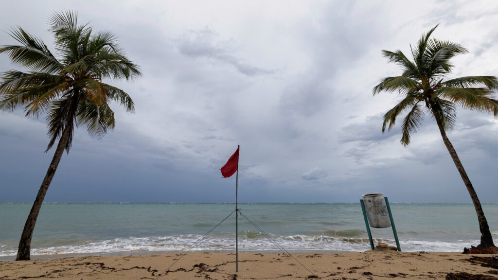
As the Hurricane Erin US coast threat grows, emergency officials in the Outer Banks of North Carolina have ordered a mandatory evacuation of Hatteras Island. Authorities fear that Highway 12, the island’s main lifeline, could be swallowed by storm surge and become impassable.
Local officials have warned residents and tourists not to underestimate the storm, citing the risks of life-threatening rip currents, coastal flooding, and hurricane-force winds that may extend far inland.
Florida and Georgia have also issued coastal warnings, with residents urged to avoid beaches due to high surf and dangerous tides.
Why Hurricane Erin Is So Dangerous
Meteorologists say that the size and intensity of Hurricane Erin make it especially hazardous. Even if the storm’s eye does not strike land, its outer bands can stretch hundreds of miles, unleashing destructive surf and heavy rainfall.
The NHC has highlighted that the storm’s “cone of uncertainty” means sudden changes in direction remain possible. Coastal cities such as Miami, Charleston, and Wilmington are all monitoring the storm closely.
Hurricane Erin US Coast: A Warning for the Future
Climate scientists note that warmer ocean waters in the Atlantic are fueling hurricanes like Erin, making them stronger and more destructive.
According to the National Oceanic and Atmospheric Administration (NOAA), the 2025 hurricane season is expected to be above average, with multiple Category 3 or higher storms likely.
This reinforces growing concerns that climate change is increasing the frequency and intensity of tropical storms, placing millions of coastal residents at higher risk each year.
Human Resilience in the Face of Disaster

For families in both the Caribbean and the US East Coast, the arrival of Hurricane Erin is more than just a weather event, it’s a test of resilience.
In Puerto Rico, residents rushed to secure homes, stock up on essentials, and check on vulnerable neighbors. In the Bahamas, families are preparing shelters, aware that even indirect impacts from hurricanes can be devastating.
On the US mainland, the looming storm has already disrupted travel, beach tourism, and fishing industries. Many residents in evacuation zones face the difficult choice of leaving their homes behind, uncertain of what they will return to once the storm passes.
Global Eyes on Hurricane Erin
The Hurricane Erin US coast crisis is being closely monitored worldwide. The storm’s rapid intensification has raised alarms among meteorologists, who continue to update real-time data on its track and strength.
Emergency agencies in both the Caribbean and the United States are in constant communication, ensuring resources are pre-positioned for potential search-and-rescue efforts.
As of now, forecasters caution that Erin is likely to remain a Category 4 hurricane for several days, making it one of the most powerful storms to threaten the US this season.
Final Thoughts
The rise of Hurricane Erin US coast is another reminder of nature’s destructive power, and the importance of preparation. With evacuations underway, homes at risk, and waves as tall as buildings, the storm underscores the need for stronger coastal defenses and global climate action.
While much uncertainty remains about its exact track, one thing is clear: Hurricane Erin will leave a lasting impact on both the Caribbean and the United States.