
Mapping the destruction
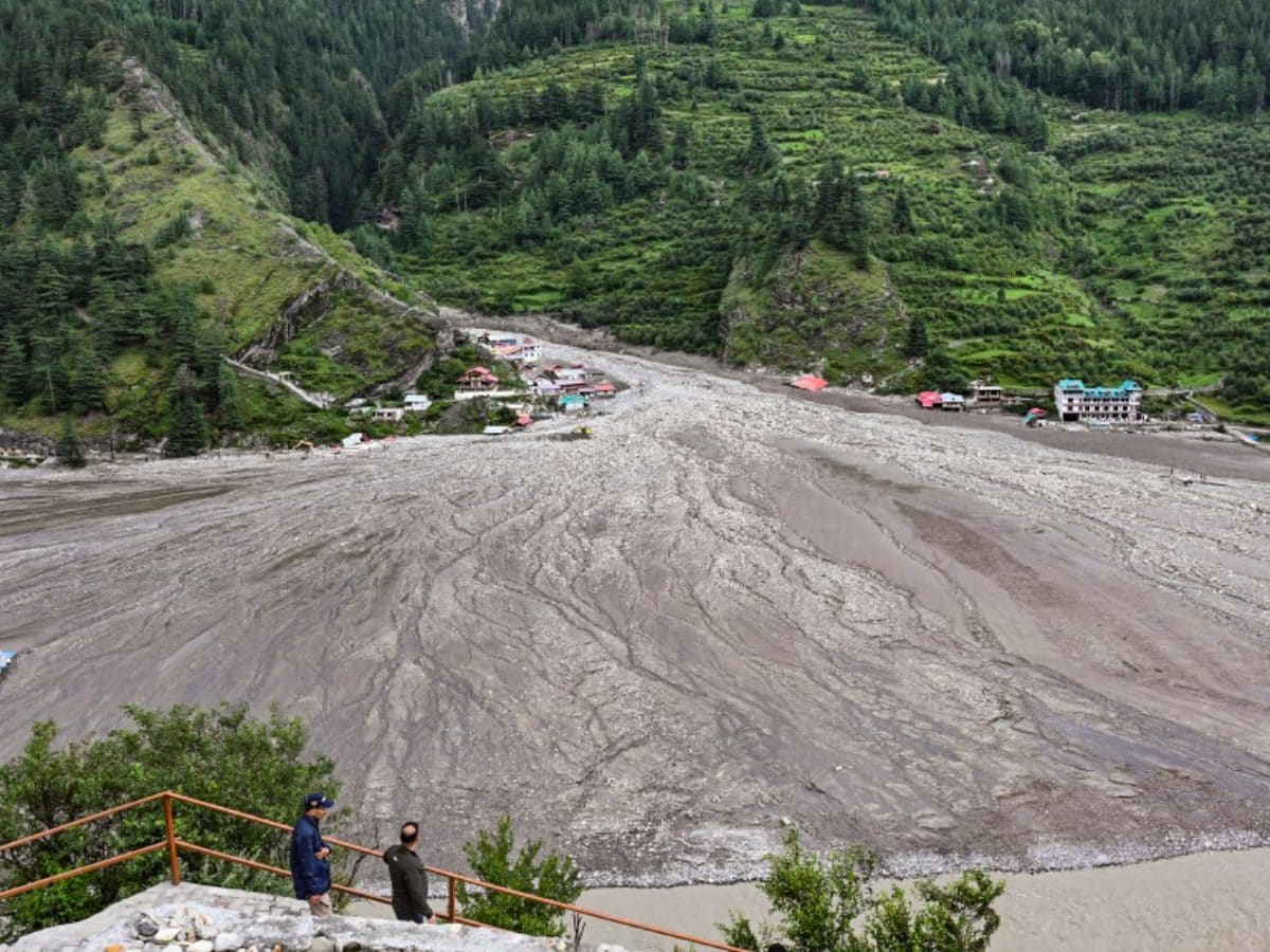
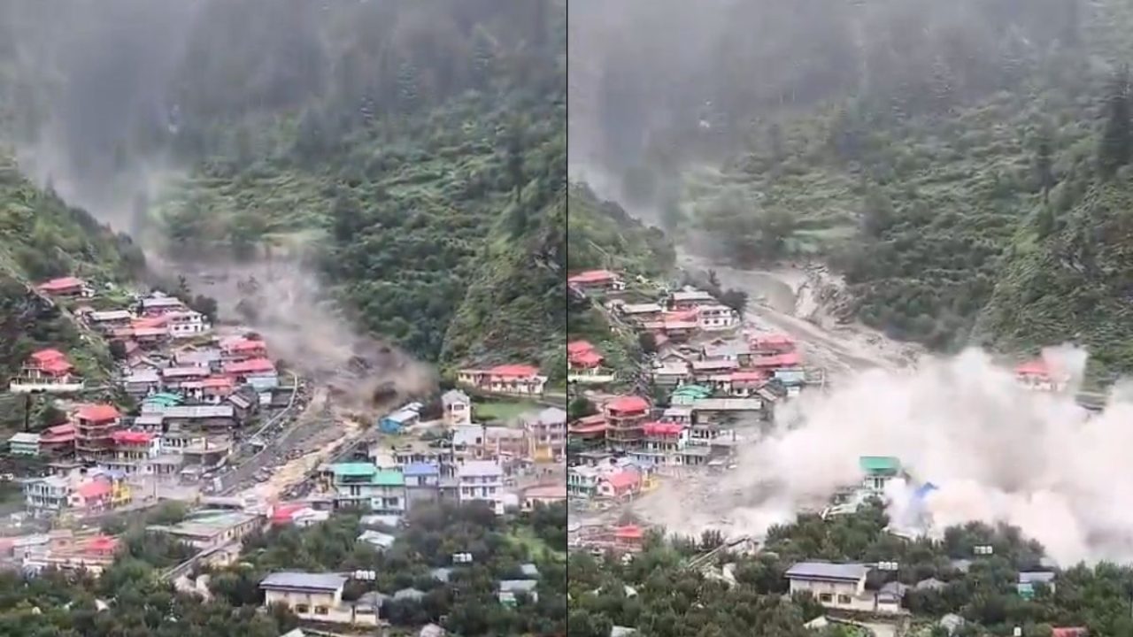
Two days after the floods hit on August 5, high resolution images from ISRO showed a huge fan shaped deposit of mud and rock at Dharali where the Kheer Gad meets the Bhagirathi river, covering almost 20 hectares and stretching about 750 by 450 meters, and many homes and shops appear to have been buried or washed away. These images come from ISRO’s Cartosat satellite and were compared with older images from June to measure the change in the land and the river course. ISRO
How the images help rescue teams
Officers say the maps from ISRO and the National Remote Sensing Centre helped pick places for search teams to focus and to plan how to reach cut off spots, and they guided efforts to reopen roads and bring people out by air when ground travel was not possible. Helicopters and teams from the army and state forces moved in after the maps showed where debris blocked paths and where river channels had shifted.
What is being counted and pulled from the site
Field teams and satellite analysts found that stream channels widened and parts of villages seem to no longer match their old locations on maps, meaning the flood moved a large amount of earth and rock in a short time, and rescue teams reported dozens of people missing while hundreds were saved or moved to safe camps. Officials say the work to find missing people and to check each site goes on in hard conditions.
Cause not fixed yet
Scientists and agencies say they cannot yet name one single trigger for the surge that hit Dharali, and they keep testing possible causes like a cloudburst, a landslide, or a break in a glacial lake, because each idea points to different risks and to different steps to reduce harm in the future. ISRO and other groups note that more data and study will be needed before the cause can be ruled in or out.
On the human cost and the work ahead
Teams report that people lost homes, gear, and local shops that served visitors, and that life for many families will be harder for a long time as they rebuild, while local leaders try to get roads, power, and water back. The scale of damage in Dharali shows how fast a place can change after a heavy rain event, and how tricky it is to sort rescue work, repairs, and long term recovery at once.
Personal analysis
The satellite photos give one of the best early reads of the ground and they cut the guesswork for rescue teams, but images alone cannot fix the larger problems that keep these events happening. The images show where mud and rocks piled up, yet they do not tell how safe nearby slopes and streams will be next season, and they do not tell how people who lost homes will find stable work or a safe place to live.
Local plans must now use the maps to guide both short term relief and a frank look at what to change in roads and building rules so that the same places do not face the same ruin again.
Sources: isro.gov.in