
Historic Satellite Takes Off to Watch Earth’s Movements
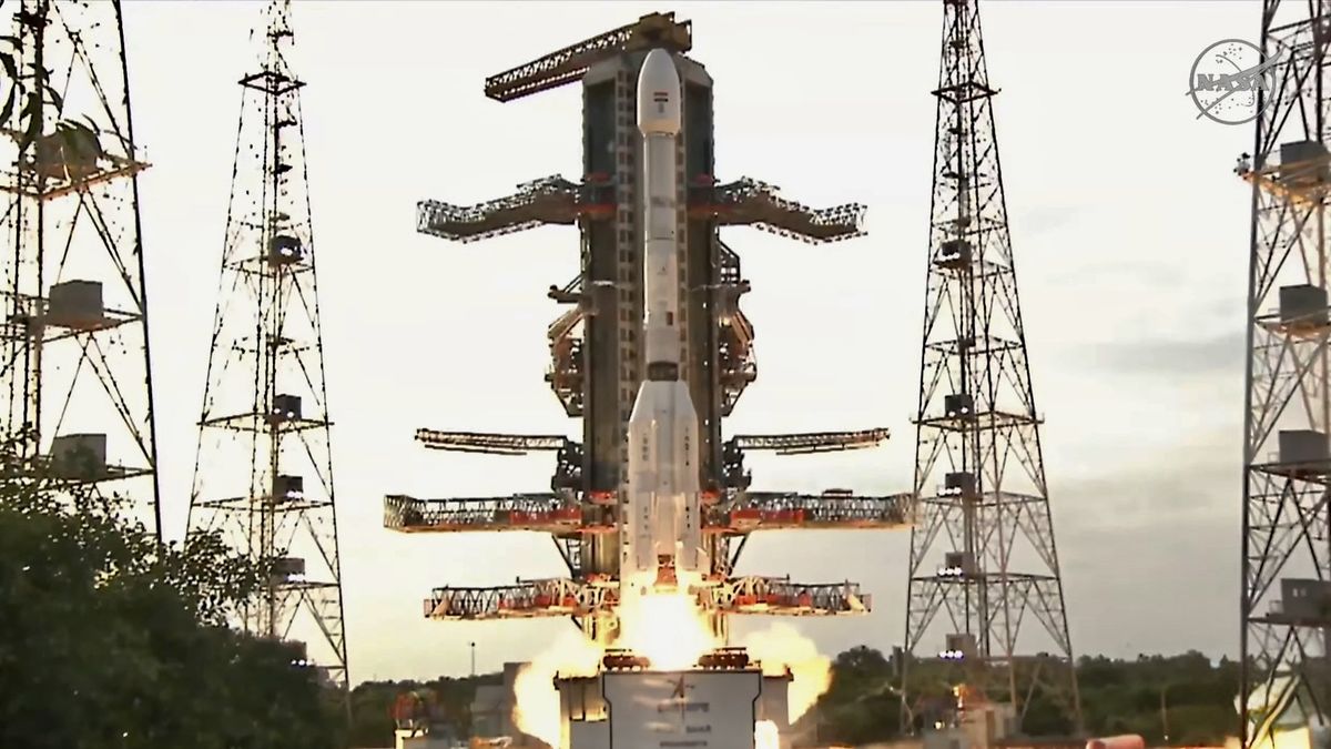
A new satellite built together by the United States and India has launched into space. It is called NISAR, short for NASA-ISRO Synthetic Aperture Radar. The goal of this mission is to spot even the smallest movements on Earth’s surface. This matters because these tiny shifts can warn us before natural disasters strike.
The launch took place at the Satish Dhawan Space Centre in India. The satellite lifted off aboard the GSLV-F16 rocket and is now in orbit. NISAR will circle the Earth 14 times a day. It will scan most of the land and ice surfaces on the planet every 12 days.
The satellite uses two radar systems: one built by NASA and the other by ISRO. These radars send microwave signals to Earth’s surface and read the reflections. This helps the satellite “see” even when it’s dark or cloudy. That’s important for spotting changes caused by earthquakes, floods, landslides, or melting ice.
Why the NISAR Mission Matters
What makes NISAR special is that it can spot changes as small as a few millimeters. These are movements we can’t see with the eye. For example, land might sink slightly before an earthquake or a volcano eruption. Catching that early could save lives.
The radar system has two bands. The L-band looks deep into forests and ice, while the S-band checks smaller details like leaves or soil. Together, they cover different types of surfaces.
NASA’s Jet Propulsion Laboratory built the L-band system. ISRO created the S-band system and also provided the rocket and satellite body. It’s a true 50-50 partnership. The two space agencies worked across 13 time zones and more than 9,000 miles apart. That meant a lot of video calls, travel, and joint testing.
The project started back in 2014. But work began even earlier, after NASA decided in 2007 that Earth observation should be a top priority. Since then, both agencies have put years into making NISAR real.
Who Benefits From This Mission?

The NISAR satellite will help scientists, governments, and even farmers. It will be useful for:
-
Disaster planning and recovery
-
Tracking melting glaciers and sea level rise
-
Watching forests and wetlands
-
Monitoring farmlands and water use
All the data from NISAR will be public. Anyone can use it. That includes people in other countries who also face natural risks.
What This Says About US-India Ties
This mission is not just about space. It also shows what happens when two large countries work together on science. As NASA’s Karen St. Germain said, “We are two nations with one mission.”
The collaboration didn’t stop at the satellite. Scientists traveled back and forth. One NASA engineer, Wendy Edelstein, said she went to India more than 25 times and spent 150 days there over the past two years.
India’s Science Minister, Dr. Jitendra Singh, called NISAR a “scientific handshake” with the world. He said it fits Prime Minister Modi’s goal of making India a helpful global partner.
Final Thoughts
This launch marks a big step in how we watch our planet. In my view, it’s also a clear sign that global problems need global solutions. Climate change, natural disasters, and resource planning affect everyone. NISAR is not just a piece of tech in space — it’s a shared effort to take care of the Earth.
And while the satellite itself is complex, the idea behind it is simple: If we pay closer attention to how the Earth moves, we can make better choices for the future.
Sources: nasa.gov