
Strong Winds and Heavy Rain to Sweep Across Northern UK
The UK is preparing for bad weather early next week as Storm Floris approaches. The Met Office has issued a yellow warning for Monday, warning that some areas in the north could face strong winds and heavy rainfall. This includes parts of Northern Ireland, Scotland, and the north of England. The weather warning will be in place from 6 in the morning on Monday until 6 the next day.
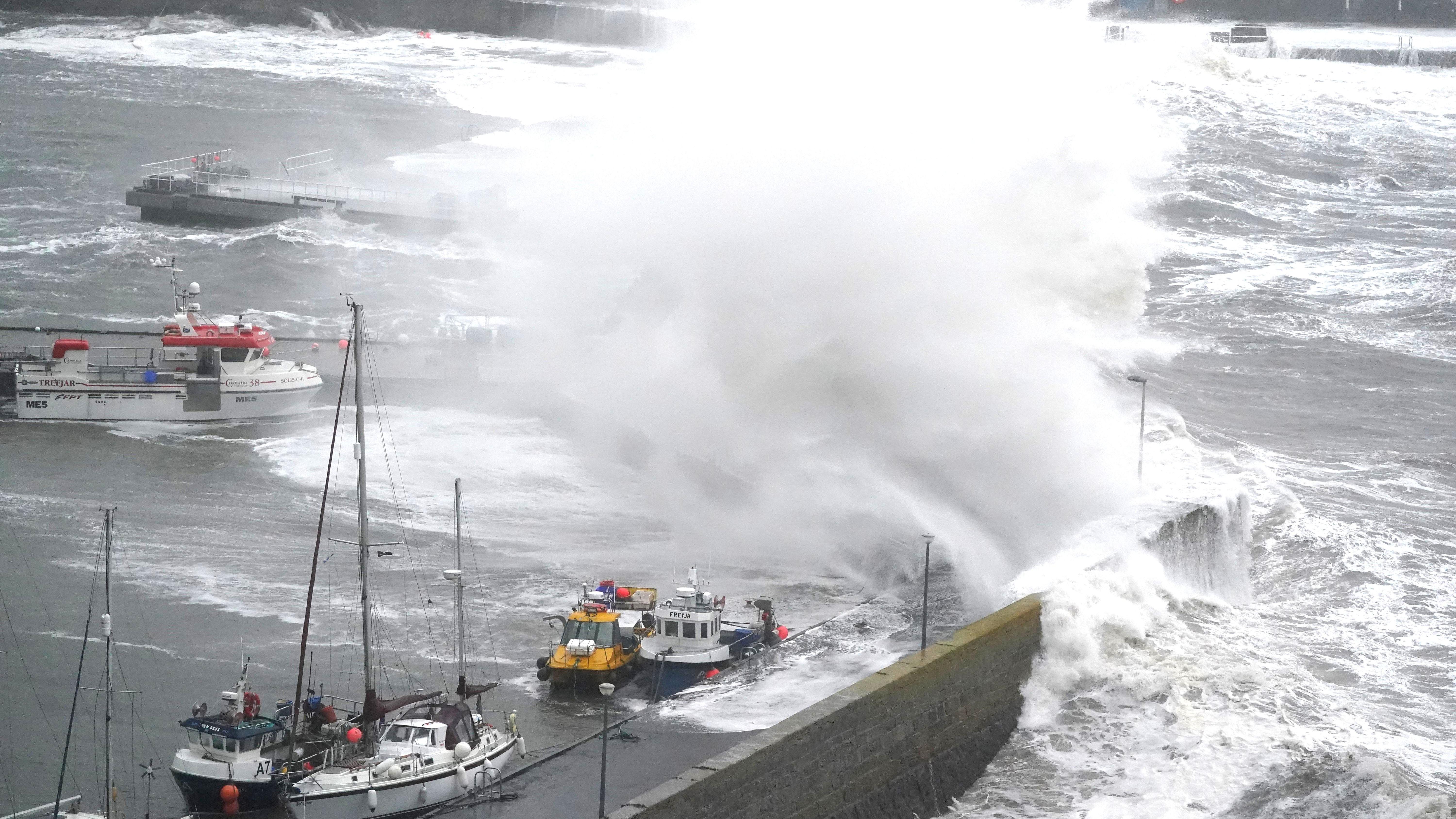
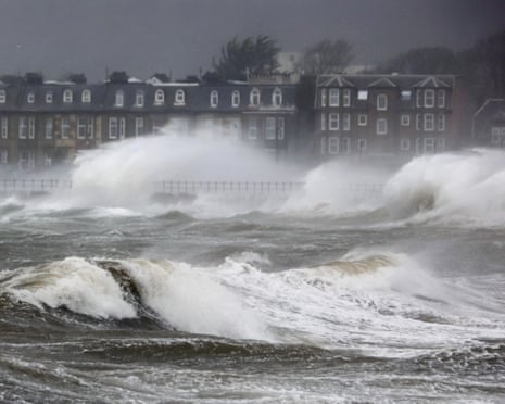
Forecasters say inland wind gusts could reach 50 miles per hour, while areas near the coast or on higher ground might see winds as high as 70 miles per hour. In some parts of Scotland, gusts could even hit 85 miles per hour. These strong winds may damage trees, rooftops, and power lines. People are also being told to watch out for flying objects, power cuts, and possible injuries caused by debris.
The Met Office shared that the strongest winds are expected in Scotland on Monday afternoon and night. But it also said that the storm’s exact path and how deep it forms in the atmosphere are still uncertain. What’s more certain is that heavy rain will fall alongside the winds, making travel difficult and increasing the chances of local flooding.
Travel and Safety Concerns on the Rise
As the storm approaches, people in the warning zones are being told to prepare for delays or disruptions to road, train, ferry, and air travel. Longer journey times and canceled services could affect thousands. Emergency teams are on standby, and local authorities may take action if the storm becomes more severe than expected.
There will be no weather alerts in place for Friday, Saturday, or Sunday. The weekend is expected to have mixed weather, some sunshine with rain in parts of the country. Storm Floris is the sixth storm to be named during the 2024–2025 season, which began last September and ends at the end of August. The last named storm was Storm Eowyn, which affected the UK back in January.
Personal Analysis: UK’s Weather Feels More Extreme
Storm Floris is another sign of how unpredictable and intense the weather in the UK is becoming. Just last month, the country recorded its fifth warmest July on record, with an average temperature of 16.8 degrees Celsius. July was also the sixth month in a row with above-average temperatures. These shifts are making it harder for people, businesses, and city planners to manage risks linked to weather.
One big problem is that storms like Floris are now coming after very warm periods, which weakens trees and soil. That means even medium winds can cause more damage than they used to. I think we need to start expecting these patterns more often. It’s not just about planning for floods or storms anymore, it’s about making cities and homes safer, especially in areas that didn’t face these problems before.
Sources: metoffice.gov.uk